Services / Real estate
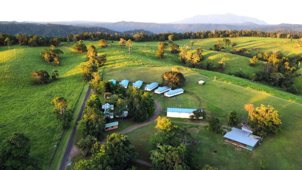
Real Estate Drone Photography in Cairns
Aerial photos and video that show buyers the whole story: the block, the views, the street and how close it is to the beach, schools and shops.
Listings that stand out on realestate.com.au and Domain
Buyers scroll fast. A strong aerial hero image stops them, and an overhead shot answers the questions ground photos cannot: how big is the land, where are the boundaries, what is next door, and how far is the water?
We work with Cairns agents, developers and private sellers on homes, acreage, rural properties, commercial buildings and land subdivisions from the Northern Beaches to the Tablelands.
Options
Choose what your listing needs
Aerial photos
Photos + video
Annotated location shots
How a property shoot works
- Send the address and preferred dates
- We check airspace (many Cairns suburbs are near the airport) and confirm timing
- We fly in good light, often alongside your ground photographer
- Edited images are delivered by download link, sized for portals and print
Privacy and neighbours
We frame shots to feature your property, keep a respectful distance from neighbouring homes and people, and follow CASA rules on flying near people and over private property.
Real estate drone photography FAQ
Can you combine the drone shoot with our ground photographer?
Yes. We regularly coordinate with photographers and agents so the aerial and ground shoots happen on the same visit.
My property is near Cairns Airport. Can you still fly?
Usually, with the right approval. Send us the address and we will confirm the airspace, any height limits and how much notice we need.
Do you photograph acreage and rural properties?
Yes. Large blocks on the Tablelands, the Cassowary Coast and the Daintree are where aerial photos help most, showing the full extent of the land, water and access.